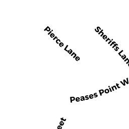
8 PEASES POINT WAY S
Owner Information
ETTINGER JOHN R &
45 EAST END AVE APT 7H
NEW YORK, NY 10028


Property Details
8 PEASES POINT WAY S is classified as a Multiple Houses on one parcel (Colonial).
The primary structure on this property was built in 2020. There are 10,579ft2 of built area within this property. There is 6,219ft2 of residential/living space within this property.
8 PEASES POINT WAY S is valued at $3,988,600. The land is valued at $2,059,600 and the structures are valued at $1,928,000. There is an additional valuation of $1,000 on this property.
This property is in Zone R5. Confirm with local Zoning Board authorities to ensure there are no overlays or other easements on this property.
The most recent deed for 8 PEASES POINT WAY S is recorded at the local registrar in Book 1101, Page 0505. 8 PEASES POINT WAY S was last sold on Monday, November 13, 2006 for $2,500,000.
Assessment data from fiscal year 2022.
Flood Data
According to the FEMA National Flood Hazard Layer, this property does not appear to be in a flood zone. It may also be in an area not yet reviewed. Nonetheless, confirm this information prior to taking any action.
To view the flood hazards around this property, create a FEMA "Firmette" Map of the area around 8 PEASES POINT WAY S.
Broadband Internet Providers
| Provider | Type | Bandwidth (mbps) | |
|---|---|---|---|
| Comcast | Cable | 1000 | 35 |
| VSAT Systems, LLC. | Satellite | 2 | 1 |
| HughesNet | Satellite | 25 | 3 |
| GCI Communication Corp. | Satellite | 0 | 0 |
| T-Mobile | Fixed Wireless | 25 | 3 |
| Verizon New England Inc. | DSL | 15 | 1 |
| Viasat Inc | Satellite | 35 | 3 |
Broadband service provider data from December 2020.